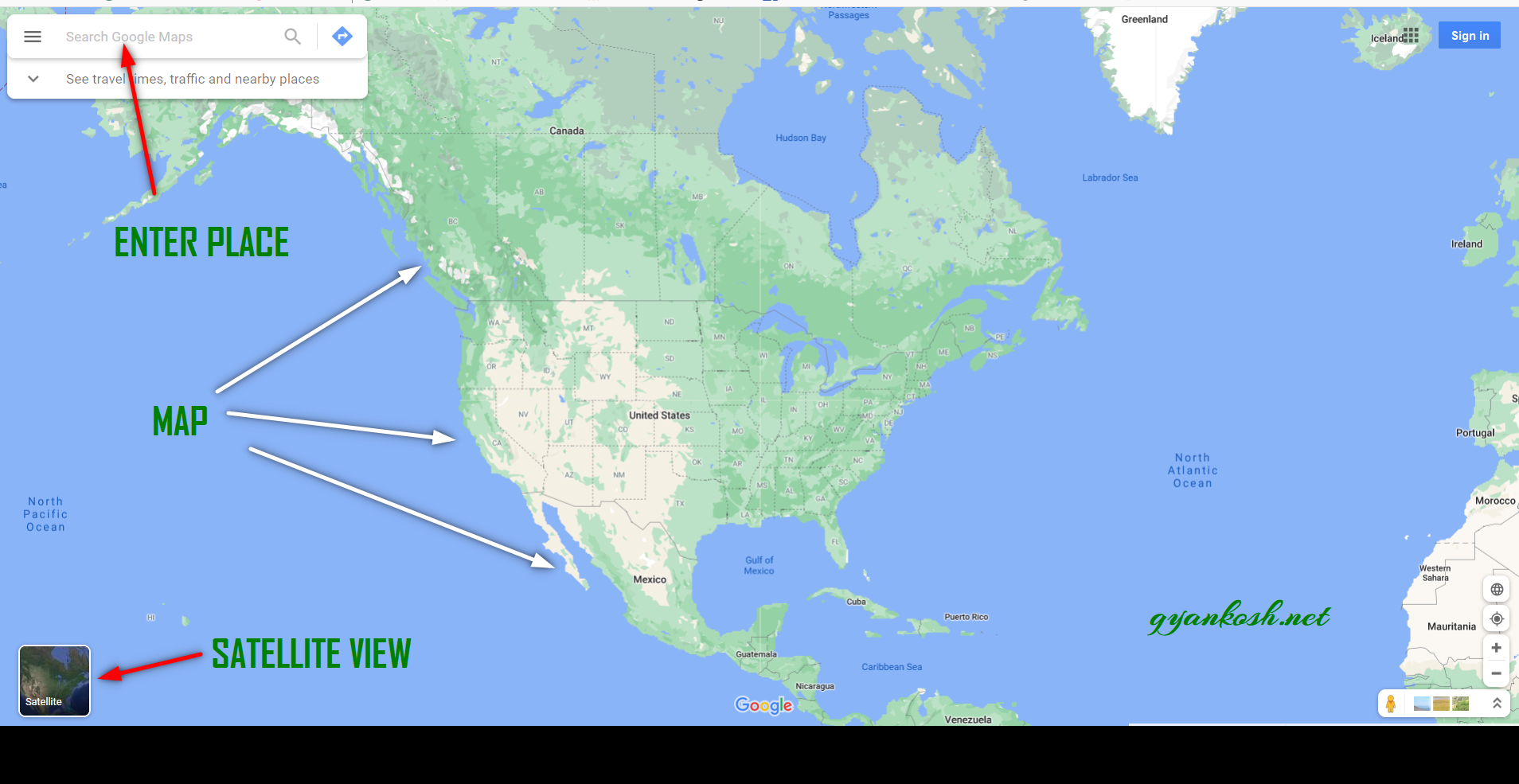
INTRODUCTION
If you are having an android phone, you must have used the GOOGLE MAPS at any point of time. This article is specially for the friends, who haven’t used them yet. Although Google Maps help you reach your destination, there are many features of google maps which are very power yet we don’t use them. One of the feature of google maps is measuring the distance between the two places.
GOOGLE MAPS IS A TOOL PROVIDED FREE OF COST BY THE GOOGLE WHICH SHOWS THE MAP OF ANY AREA [ COVERS MOST OF THE PART OF THE WORLD ] , ROADS, SERVICES, HOTELS, GAS STATIONS AND MUCH MORE. IT AIDS IN DRIVING TOO BY SHOWING US THE BEST WAY TO REACH OUR DESTINATION. CLICK HERE TO OPEN GOOGLE MAPS.
In this article we’d learn to measure the distance between two points or places in google maps for pc [ Browser ]
HOW TO OPEN GOOGLE MAPS
Google maps are available at three places mainly.
GOOGLE MAPS for the internet which can be accessed using the BROWSER :
Open the link www.maps.google.com . Open the link and it’ll take us to the google maps.
GOOGLE MAPS for ANDROID. It is available in the Android Mobiles as an App known as GOOGLE MAPS. Click the app to open it.
GOOGLE MAPS for IPHONE/IPAD.It is available in Iphone or Ipad as an App known an GOOGLE MAPS. Click the app to open it.
The look and feel is same as for the android. Look picture above.
HOW TO MEASURE DISTANCE BETWEEN TWO PLACES IN GOOGLE MAPS [ BROWSER ]
After we have opened the GOOGLE MAPS, follow the steps to measure the distance between two places.
- Open the browser and put the address maps.google.com.
- Click Enter.
- Drag the map to the required location.
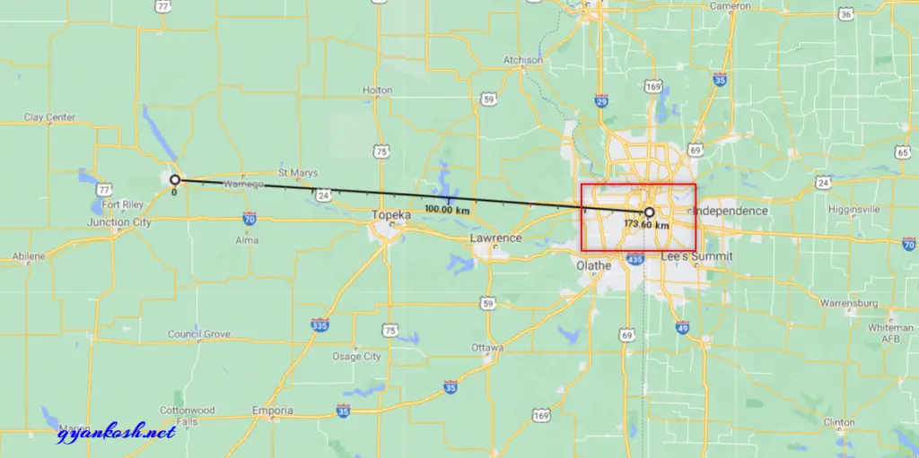
- The following picture shows the place where we want to find the distance between. We want to find out the distance between Manhattan and Kansas City. We scrolled the map to show the areas in picture. We can zoom in and out to make the places visible. No difference in the distance will be there.
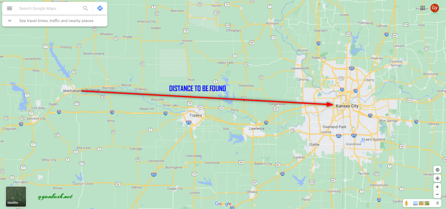
- Right Click on any one of the two places between which you want to find out the distance.
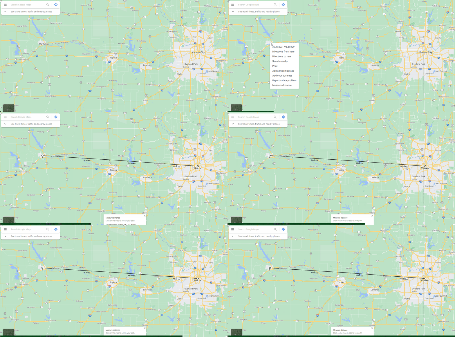
- As we RIGHT CLICK the place, a menu will open.
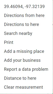
- Choose Measure Distance.
- It’ll create a small circle on the place where we clicked Right.
- Now click on the Second place.
- It’ll create a straight line and measure the aerial distance between the two places.
- The end point will show the total distance between the two points or places.
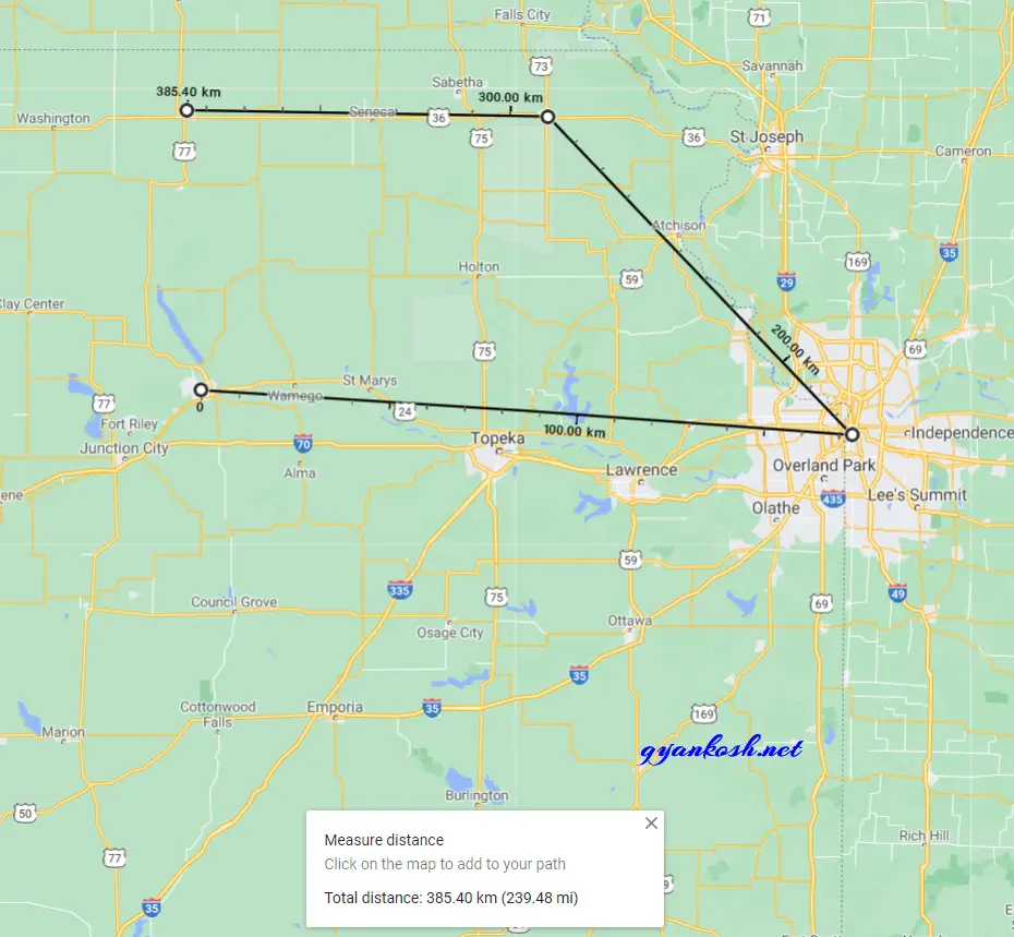
- The distance is also shown in a dedicated CARD at the bottom of the screen in MILES and KILOMETERS.

HOW TO ADD ADDITIONAL POINTS IN THE GOOGLE MAPS [ BROWSER ]
- After the measurement has started, simply click on the point and it’ll be added to the measurement.
- Click on the small circle to remove it from the measurement.
HOW TO CLEAR MEASUREMENT FROM THE GOOGLE MAPS [ BROWSER ]
- Right Click and choose clear measurement.
- Measurement can be cleared by clicking CROSS in the distance showing card at the bottom.
